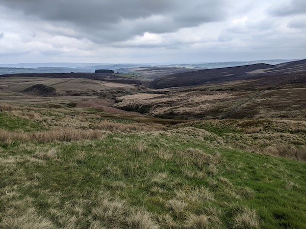
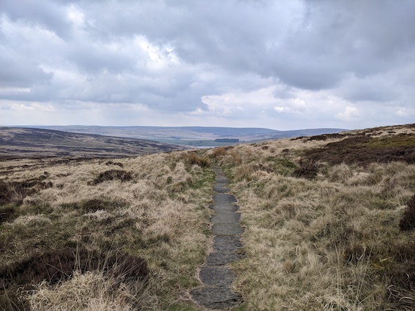
Stage 4 of the Pennine Way is a satisfying one. It rises from the Calder Valley to cross Heptonstall Moor, then passes a reservoir on the way to the ruins of Top Withens. The pathways are wild and empty, with some great scenery.
As much as I love the image of the Pennine Way as a thin path up the spine of the country, the way-finding sometimes feels wearing. The guidebook I follow describes the route closely (as Wainwright’s guides does), with little attention paid to the wider scenery. Wainwright himself compares this to following the path with blinkers on, having no idea of its context. It can also feel fussy to be looking ahead to the upcoming gates and the twists in the track.
One answer to this would be to switch to navigating from the OS map – which I keep in reserve in case I need to find a route away from the trail for some reason. But I’ve also been wondering about how the route could be divided up differently, and treated as a journey between waypoints. This would make navigation harder on some sections, but I like how this breaks things into sections. I think it’s also a better narrative, so I’ll try it with the description of this walk.
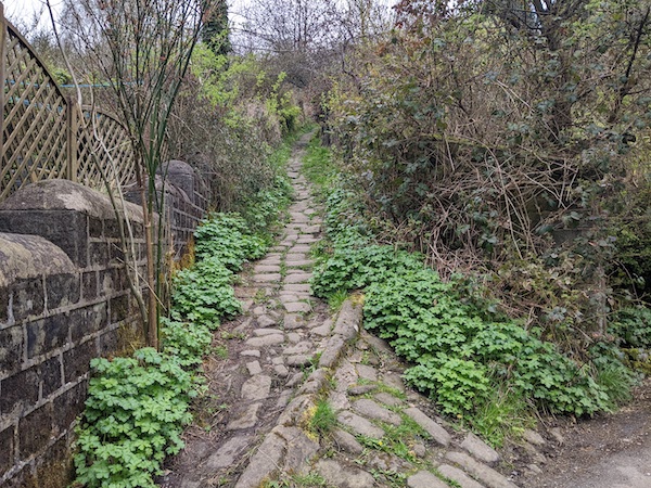
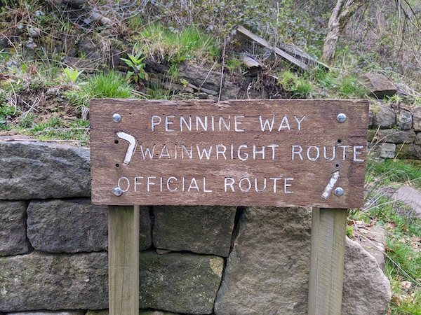
The day’s first stage was the climb out of the Calder valley from the canal. The climb starts with a lovely steep cobbled path. I considered buying a house next to this before I realised I did not have the energy to handle the renovations. The climb passes the ruins of a chapel with a tiny graveyard, and a sign that offers two paths, Wainwright’s preference and the ‘official path’. There is no one Pennine Way.
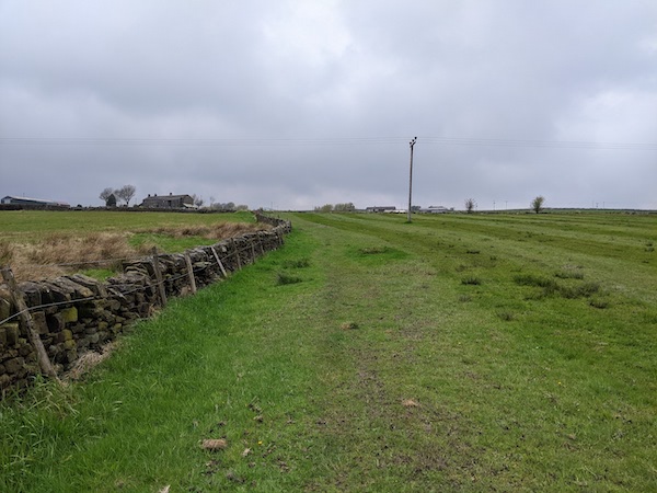
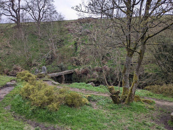
The second stage involved crossing a valley, down to the old bridge at Colden Water then following a rising path through Colden village. There’s a lovely little farmshop just off the path here, called May’s Aladdin’s Cave. It’s a good climb out, which continues to a cairn with a ‘good luck’ sign embedded in it. Here the path turns to the left and sets out on another stage across barren Heptonstall Moor.
The fourth stage follows a farm track then heads down through a tiny, pretty valley before rising towards a road. A short way off is the Pack Horse Inn, which is a good place to stop for lunch. The main route follows some quiet roads until turning off towards a reservoir.
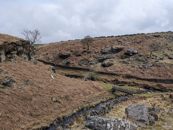
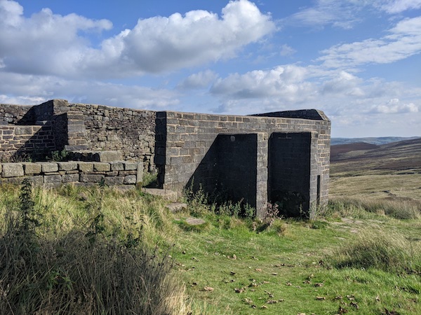
The path around the reservoir is easy to follow, as long as you know where the turn-off is. There is a flagstone path out of the valley which descends near the ruins of Top Withens farmhouse. I love this ruin, which is famous for not actually being the sight of Wuthering Heights from the Emily Bronte novel. A sign says this building is not the one in the book here, but people still trek out here because the place is famous for not being the ruin, and people once confused the two. It’s a beautiful lonely place.
From Top Withens its a relatively short downhill section towards Ponden Reservoir, which was my finishing point for today. From here, I had to trek back to Haworth, from where I could pick up the bus. The road took me past the Old Silent Inn, which is so named because Bonnie Prince Charlie stayed there on his retreat, and the locals did not betray him. The pub is, of course, rumoured to have a few ghosts.
Travelling from Ponden back home was a drag. I discovered that I had dropped my trusty coffee cup somewhere along the way. I’d missed the bus to Howarth by ten minutes, so walked. It was touch-and-go as to whether I could make the bus from Howarth to home, but I decided to wait for the next one and do some book-shopping. I’ve started collecting old guidebooks to the Pennine Way, and picked up an interesting one from the 90s, as well as a book on drystone walls with the portentous title Who were the Wall-Builders?
,