Walking the Brighton Pub Ley: an experiment

The threshold for how many places you need to generate ley-lines is surprisingly low. As computers became powerful enough to demonstrate this for mundane sites (like public toilets or pizza restaurants) mainstream ley line research died away. What remained of the subject was absorbed into new age thought, where the burdens of proof were lower.

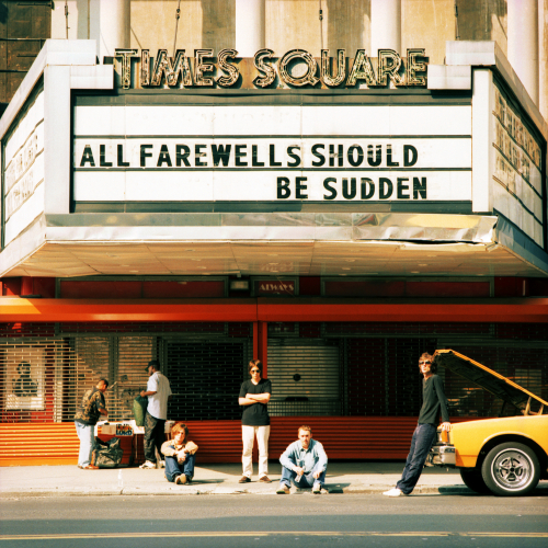
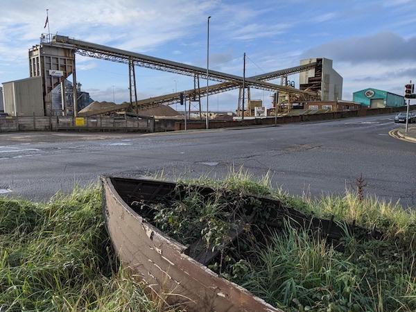
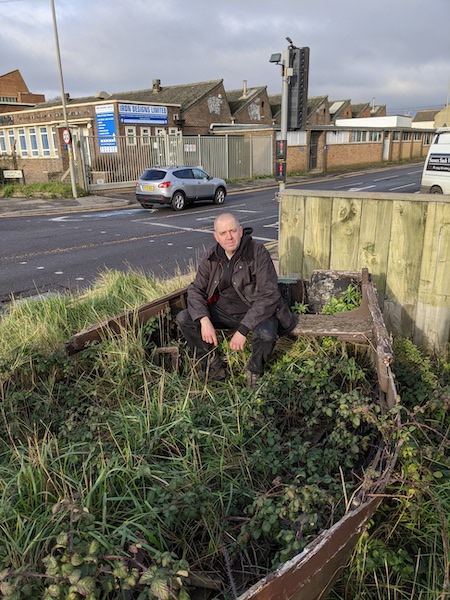
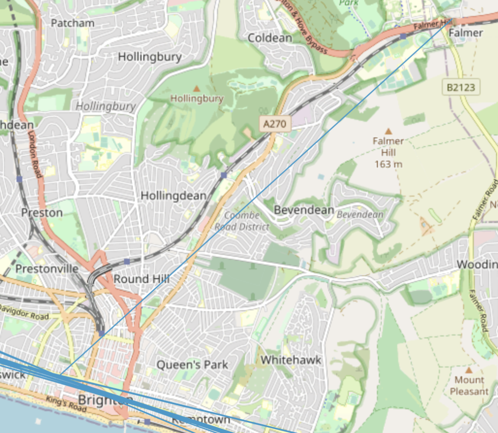
Back in lockdown 3, I walked along a ‘synthetic ley’, the major north/south alignment of Brighton pubs. If you chart the lines between pubs, there is a large number of east-west alignments parallel to the seafront. Which makes sense, given that you would expect the town’s pubs would to be placed along the seafront and the main coast roads. There is however, one line which strikes roughly northwest, beginning at the Pull and Pump, then heading via the Bear Inn to the Swan in Falmer.

There was obviously no question of this line being constructed intentionally. Despite that, following the line threw up a number of synchronicities ands strangeness that would have strongly corroborated a line made of more ancient sites. It was a surprising result.

The first few sections were nothing special and I wondered if this was a waste of time. Ben pointed out the pub that hosted an early Festival 23 event, and the one where he first read poetry. They were some way off the line, however, even if they looked closer in real life than on the map.

Things became more interesting as we reached the North Laine. The line passed through the Prince Albert, one of Brighton’s most iconic pubs. From there, it entered the office block complex opposite, directly through a desk I’d worked at. An even bigger surprise came on the other side of these offices. The ley intersects the Brighton stone circle twice, but it actually passed through the 39th stone. A little later on it passed through a house I used to live in.

As well as personal resonances, there was the fact that the line passed through the Druid’s Head pub, perhaps hinting at where this line might have emerged? I’d not even realised that the Druid’s head was on the line – possibly it was closed when the dataset I had was generated. And then there were references to stellar alignments in the Bear and Swan pubs, referencing their respective constellation.

As a ley line, the Brighton Pub Ley is obviously just a matter of chance. Despite that, it was still deeply meaningful, on a personal level and a wider one. The experiment of creating this ley suggests that interesting work can be done using public GIS data and the right scripts to develop interesting, meaningful lines in any city.

Things to do before I leave town

Things to do before you leave town… It’s been a long drawn-out process, but it looks as if I am close to selling the flat. Obviously, it’s best to take nothing for granted when moving house, but the schedule is finally falling into place and… if everything goes through, it will be sooner than I expected. Maybe even this month.

The next few weeks are likely to be a mess of undignified packing and logistics. I’m not going to get chance to say goodbye to everyone (hardly anyone!) before I leave, but I will be back relatively soon to say goodbye properly. Far better to enjoy that, than trying to squeeze it in among everything else I need to do before leaving. And, you know, I’d hate to have a big occasion then have things fall through and be here another four months.

I first moved to Brighton in October 1994, and the town has changed a lot. I still love it, but I also need a change. I want to settle into a new place and build new patterns, find new landscapes. I’ve left Brighton before, but that was always with the intention of coming back. This time, it will be for good.

The immediate future holds lots of putting things into boxes. I’m looking forward to having a calming cup of tea with that out of the way. Then, I will get on with organising a leaving party.

Sorry to anyone who’s hearing about this for the first time. The pandemic is a weird time, and I’d also not wanted to jinx things.

Also! How fucking exciting! I am going to be living somewhere new this summer!

The Cult of the Seagull

Back in February 2020, walking to Hove station for my commuter train, a bird dropped a bone on my head. The image feels almost too rich with symbolism, given what was coming. And, of course, this bird of ill-omen was a seagull.

Brighton belongs to the seagulls. Whenever rubbish goes uncollected, they scatter litter on the streets. They trash the town like the worst stag night tourists. They scream and shout, waking people in the mornings. Netting doesn’t keep them out. They’ll attack people for chips, making it dangerous to eat in the open.

(There is a shop at the end of my road, which has fruit and veg in stands outside. I’ve always wondered how it copes with the local seagulls. So, I asked the shopkeeper one Sunday. Apparently, the seagulls are no trouble in the winter, but in the summer they can be. Strawberries, blueberries and raspberries are among their favourites, but more than anything else they love peaches.)

Brighton’s seagulls are vicious. I’ve had them stalk me down the street to have a go at stealing a baguette. Another landed at a table to grab the sandwich from a plate waiting opposite. They’re vicious thieving bastards.

They seem to know they cannot legally be killed. Some of them must suppose they are a holy thing, a beloved and adored bird. They will assume that we build houses as places where they can perch and nest, that we serve them our rubbish. We like to pretend that Brighton is a human town, but really it belongs to the seagulls.

They are the Bullingdon Birds, like little Tories, causing noise and mess, not caring for the smaller birds. They’d steal the food from hungry school children in a minute. I’ve seen them cruelly tear apart pigeons. Brighton is their city.

Brighton and the Internet of Place

“The Internet of Place” is a great buzzword. When you hear it, you know what it might be, and the concept rhymes well with “Internet of Things”. You imagine small autonomous nodes, taking advantage of their locations in the real world; a blossoming of tiny interactions with the world that makes life more convenient, interesting and meaningful.

In 2015, Brighton was chosen as one of the digital catapult centres, receiving funding and support to set up a variety of technical initiatives, including the Internet of Place. The requirements were open ended, as explained by Nick Hibberd, the head of city regeneration at Brighton & Hove city council: “By allowing a collaborative space, innovation will come. But innovation by its very definition means you don’t know where it’s going to end”. It was intended to provide collaboration between public sector, universities, SMEs, Amex and Gatwick Airport, “to turn Brighton’s best digital ideas from concept into reality, creating new products, services, jobs and value for the local economy”.

The Internet of Place was about combining Internet of Things (IOT) devices with geographical locations. But this vision went beyond the sort of tedious location-based ideas that I’ve seen pushed since the early days of SMS. As the Guardian wrote:

Local leaders also want to use the internet of place to improve the way the city manages its infrastructure, including transport systems, and the 11 million tourists who visit each year. There could be apps to direct drivers away from the most congested areas and help them find free parking spaces. Improving public transport and encouraging visitors to use park and ride facilities

Another important aspect of the catapult was to unlock local data services, with the idea that “data sharing will also help to create better services, from transport to healthcare”. The article explains how data is potentially highly valuable, and exposing it to the world could produce a significant economic boost, with the 5G test network adding to this.

The Internet of Place was also intended to support local business who might not have the technical skills or money to provide a rich digital experience. The Guardian interviewed Ben Potter, from marketing agency Leapfrog, who talked about the IOP driving business to shops without an internet presence: “If we can create a platform that understands the main interests of consumers – such as films, food, clothing brands – then local retailers can send out targeted messages to people’s mobile phones as they walk past,

(This vision brings with it the danger of location-based spam, one of the big flaws in location based marketing since the early days. How do you engage people while also interrupting them? I’m assuming there are ways to do this, but those challenges probably dwarf the technical ones)

The digital catapult funding has produced two successes in the 5G testbed and am immersive tech lab supporting the production of AR and VR applications. But the promised internet of place applications never appeared.

Searching Google for mentions of the term in the past year returns only a handful of results. It’s a shame, considering how exciting a vision had been laid out a few years before. Given the creativity in Brighton’s tech scene, I can’t imagine what ideas we might have seen around wayfinding, location, retail, , tourism, art and games.

New Atlas Obscura Site: The Portslade Gassie

A new Atlas Obscura entry recently appeared near my house, for something I’d never heard of: the Portslade Gassie. I’d walked past the site several times without noticing anything, so it seemed like a good destination for a walk.

Apparently, there were several of these wooden boats, which acted as a form of public transport across a canal to the gas works. The site the boats were used to reach was 40 acres large by 1926, according to the sign.

The boat itself is a ruin, and the site of a busy, grim junction. Litter in the area was hidden by weeds. It made me wonder who maintains these things, and decides they must stay in place, even as they become overgrown and ruined. I wondered who this was placed here for. Was someone waiting for the boat to rot enough that it could be removed? But, if nothing else, it provided something to see on an empty lockdown Sunday.

A pandemic artwork on Hove Lawns

At some point in the early hours of Friday morning (10th July), an artwork appeared on Hove Lawns. Tens of thousands of pebbles had been laid out on the east end in the shape of the UK’s official Coronavirus death toll:

It’s a stark and thought-provoking piece of work, placing this horrific number into the midst of a public area. My first response was amazement at seeing each stone had been individually numbered. At first, questions about the piece’s construction were a distraction from its meaning, until that came back with a shock. Each one of these tens of thousands of pebbles represented a life lost.

The following day, on my daily walk, I saw the artist and got talking to someone who described themselves as their ‘gofer’. He said he’d written some of the numbers, an effort that had taken a week’s work to complete. He had burst into tears at one point, he told me, the stark numbers suddenly reminding him of the tattooed numbers at Belsen. That comparison feels problematic to me, but I can understand it.

The piece is confrontational, particularly when we’re being told that it’s our duty to go back to pubs and restaurants; while, at the same time, government ministers say mask-wearing should not be mandatory, even though they might save lives, even though there seems to be little downside. This is just another number we’ve got used to, alongside millions who die of hunger each year.

Another question about the artwork is why that number, which is the official death toll. The Gofer said it was picked because that number was controversial, and the artist wanted people to think about it. Looking at the piece on Friday lunchtime with Kate Shields, we got talking with a couple who told us about their friend. This person had been suffering a variety of conditions related to cancer, but had been marked as dying of coronavirus; and the family felt this was incorrect, that this cause of death was a political move.

Photograph by Kate Shields

The number formed by the pebbles is being updated daily. The shock of the artwork will diminish, and I’m not sure how long it will survive in its current location. Maybe people will encounter the numbered pebbles on the beach in years to come, and wonder who wrote on this pebble, and why?

Back in March, Stephen Powis said of the coming death toll, “If it is less than 20,000… that would be a good result though every death is a tragedy, but we should not be complacent about that

The larger a number, the more difficult it is to reason about.

Back to The Brighton and Hove Way

During Summer, the Brighton Explorer’s Club would normally be off on adventures, but lockdown means looking for excitment closer to home. During June, the group has had teams walking the Brighton and Hove Way.

I walked the entire Brighton and Hove Way in a single day on the May bank holiday. It’s a great trail, although doing in one hot day was hard, brutal work – it turns out the 27km distance listed on the website was a typo, and it’s 27 miles. It’s been more fun split into three sections with a (socially-distanced) group. The team event has been well-organised, with a photography competition as well as a quiz.

So far, our group has done two outings walking the sections between Dyke Road through to Falmer via the seafront, leaving a fun stretch along the Downs at the back of the town as our finial journey.

On my first trip, I complained a little about the GPS trail. The exit from Balsdean was actually more obvious than I realised, as well as more scenic. The section around suburban Portslade was still a little tricky, however. The route’s organisers are working to get funding for signage, but progress is slow.

It’s less than a month since I first walked the route, but the changes are notable, particularly the growing crops and bright poppies month them. It’s also been far more fun walking the trail with company.

On the section near Balsdean, we found this huge lump of quartz. It was about a foot across. I have no idea how it came to be on the path. According to Jim Mellor: “the piece of quartz in the photo from the Brighton and Hove Way could be a ‘salt lick’ – a mineral lump left out for cattle as a diet supplement”

With the grass and crops being taller, the wind causes waves to run across the hills. It’s quite a beautiful effect, which the photograph below only hints at:

Looking back towards Balsdean from the correct path out of the valley, rather than the one I took originally.

It’s always good to see the ‘This Way’ markers about the place.

Deadline 22/6/20: Finally! A use for the Brighton i360

According to Brighton and Hove News , “A petition calling for marking on the pavement around the i360 showing the time and date goes before the Environment, Transport and Sustainability Committee on Tuesday 23 June.

The petition is available on the council’s petition site and, at present has a mere 57 signatures. It states, “We wish to create an educational attraction that demonstrates how our ancient ancestors developed the measurement of time and date by creating dial plats around a vertical post used gnomon,” and suggests marking various pavements around the town, replicating Augustus’ sundial in Rome.

This seems an excellent way of redeeming a rather disappointing project. The i360 has missed its targets both for visitors and for repaying its loan from the council. (It’s worth adding that the visitor estimates were viable, making the failures even more disappointing). The restaurant, despite a superb location, seems to be promoted ambivalently – someone recently recommended it to me as a great place for meetings, since it was “almost always empty”. The i360 should have been at the center of a thriving and exciting area, but has made little impression.

I’ve long been disappointed with the i360. It was used as a reason for removing some of the beautiful ruins of the West Pier, and a distraction from any feasible project for renovation or replacement of the old pier. It’s hard not to see the i360 as establishing a beach head for commercial development of the beach.

The only real value in the i360, for me, is its height, functioning as a landmark for Brighton in the surrounding landscape. It’s visible on the Downs from Chanctonbury to Firle and I’ve even referred to the i360 as a gnomon myself, with its placement at the center of a long arc of the South Downs. It’s an eyesore close up, but its height makes it a feature from a distance. Maybe using it as a sundial within the town would be a good way of making it more interesting close up.

The i360 was promoted by the West Pier Trust as “putting [Brighton] absolutely fairly and squarely back on the map as an exciting, glamorous and daring place to be”. It’s not done that and it’s possibly unfair to expect the i360 to live up to its own hyperbole. But turning it into a sundial seems like a definite improvement.

May Day

Every year, as May 1st approaches, I start making plans to see the Brighton Morris Men dance in the summer at Hollingbury Fort.

The night before, the Morris Men dance at a series of Hanover pubs. They retire to someone’s house for a few more drinks and then head out onto the Downs in time for dawn.

Every year, almost without fail, I decide against setting my alarm to watch the dancers. I’ve only actually made it once, back in the noughties. I remember trying to find my way in the dark, following the sound of bells. As the sky lightened, dancers circled the fort, just about keeping their footing on the damp grass. It was a magical experience, and I wish I’d taken the opportunity to do it more often.

I love the rituals that mark our passage through the year. There’s an importance to the continuity of these things. Obviously, I could not go and see the ritual this year – but I hope it still took place. I’d like to think there were a handful of socially-distanced dancers, setting the summer in motion.

The Burning of the Clocks

The Burning of the Clock’s is one of Brighton’s annual festivals. Taking place on the Winter Soltice, a few days before Christmas, it was started by the arts group Same Sky in 1993. It involves a procession of lanterns through the town to the beach where they are ceremonially burned.

I’ve been to the Burning of the Clocks a few times over the years. Most times I’ve watched the parade, then wandered to the beach where I found myself in a massive crowd. Some years, unable to see anything, I’ve headed for a warm bar before the fireworks.

This year was different, because the event took place in appalling weather. It was not as bad as 2009, where snow and ice caused the festival to be cancelled; but the rain meant the crowds were much thinner. Despite the weather, the samba bands were there, and I admire the people who kept dancing in costumes designed for summer rather than winter rain.

We waited on the seafront as the lanterns were stripped of fairylights and added to the bonfire. It took some time to light, eventually getting going with some kerosene. For once, I had a perfect view of the event, although wind meant the fireworks were cancelled.

I’m glad the burning of the clocks went ahead despite the rain, and that people did turn out. And I am also glad that I was able to see it clearly this year.

It’s good to have these events to mark the year:

A few years ago I attended the first of Brighton’s traditional March of the Mermaid events. I walked in the drizzle from Hove Lawns to Brighton Pier with a crowd of people in fancy dress. At the traffic lights near the aquariums, an Italian woman asked me what the festival was and I told her. She asked me what it was for and I couldn’t say.