I’ve always been a little jealous of people with the time and location to collect Munros and Wainwrights. All the interesting climbs in Britain are some distance from the south coast. The chalk geology of Sussex does not lead to exciting peaks – the highest point is a mere 280m, at Blackdown. I mean, it’s better than Essex (highest point 147m) or Norfolk (103m), but it’s not much.
In November 2017, the Brighton Urban Ramblers did a City Three Peaks, but they went for steepest streets rather than highest points, picking Dyke Road, Preston Drove, and Southover Street. Still, there are high points in Sussex, which means they can be collected.
There is a list of Brighton Hills in Tim Carder’s Encylopedia of Brighton which is reproduced on My Brighton and Hove, although the heights are given in feet. Taking an arbitrary cut-off at 100m, the ‘peaks’ within the borough are:
- 645 Bullock Hill, Woodingdean
- 584 Hollingbury, Patcham
- 580 Holt Hill, Patcham
- 534 Falmer Hill, off Falmer Road
- 531 near Pudding Bag Wood, StanmerPark
- 510 Varncombe Hill, Patcham
- 509 The Bostle, Woodingdean
- 503 Heath Hill, Woodingdean
- 485 Tegdown Hill, Patcham
- 476 on Ditchling Road south of Old Boat Corner
- 463 Race Hill, by Bear Road
- 435 Scare Hill, Patcham
- 430 in Stanmer Great Wood
- 430 Red Hill, Westdene
- 427 Sweet Hill, Patcham
- 417 Race Hill, by the Race Stands
- 417 Telscombe Tye, Saltdean
- 411 at Balsdean Reservoir
- 410 Ewebottom Hill, Patcham
- 398 High Hill, Balsdean
- 396 Whitehawk Hill, Brighton
- 387 Coney Hill, Westdene
- 367 Mount Pleasant, Woodingdean
- 355 on Dyke Road Avenue, near Dyke Road Place
- 352 Red Hill, Roedean
- 334 Tenant Hill, Saltdean
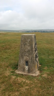
That is a lot of hills. I decided that a better starting point would be the trig pillars, since they should have good views and account for Topographic prominence. There is an excellent database of trigpoints at trigpointing.uk, which includes all the trig points around Brighton. Some of these are listed as destroyed, but are still useful target locations. Their catalogue of Brighton trig points includes 6 pillars:
- Bullocks Hill (195.8m)
- Hollingbury Castle (178.5m)
- Stanmer (152.8) – listed as destroyed
- The Drove (126.9m) – which is listed as ‘destroyed’
- Mount Pleasant (112.1m)
- East Brighton Golf Course (107.7m)
I’m going to take this as the starting point for my ‘Brighton Peak bagging’, although it makes sense to expand this into the wider Brighton Downs – using the arbitrary definition of the area covered by Dave Bang’s book A Freedom to Roam Guide to the Brighton Downs. This would expand the area to cover Beeding Hill through to Lewes, also including the north slope of Clayton Hill and Ditchling Beacon. So far, I’ve done one of the trig points, now I just need to divide the others into a few sensible routes.
Anyone interested in joining me for a session of Brighton peak-bagging?
If you want to follow what I'm up to, sign up to my mailing list